Sacramento Flood
Preparedness Mapping
Location: Sacramento, California
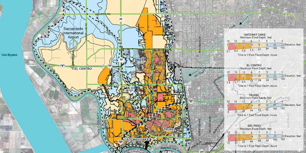
As an element of the 1996 City of Sacramento comprehensive Flood Management Plan, Wood Rodgers was tasked with updating flood preparedness mapping for both the City and County of Sacramento using high resolution elevation data, LiDAR, and advanced floodplain mapping tools. A combination of software packages including GIS, HEC-RAS, and GeoHEC-RAS were used to prepare these maps. The maps proved to be an effective tool to refine flood emergency preparedness procedures and protocol, as well as to communicate flood risks to the public and media.


Leave a Comment
You must be logged in to post a comment.