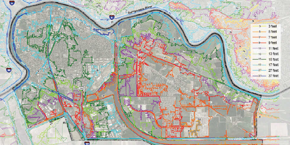
As an element of the City of West Sacramento comprehensive Flood Emergency Management Plan, Wood Rodgers prepared flood emergency preparedness maps using LiDAR topographic mapping and advanced mapping tools for levee failure analyses and floodplain mapping. GIS and Spatial Analyst were utilized to integrate with DHI’s MIKE FLOOD hydraulic modeling software, to build the topographic surface and extract and map the maximum flood depths and inundation time spans for two hypothetical levee failure locations. Evacuation routes were classified according to their impassable inundation times at approximately one-foot depth over the local roads and highways. The maps, while being used for the flood emergency preparedness procedures and protocol for the City of West Sacramento, have also proved to be an effective tool for communicating flood risks to the public and media.
Home
› Page › City of West Sacramento
City of West Sacramento
Location: West Sacramento, California


Leave a Comment
You must be logged in to post a comment.