City of Anderson Pedestrian
Master Plan
Location: Anderson, California
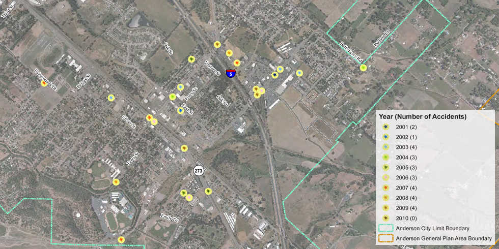
The City of Anderson retained Wood Rodgers to develop a Pedestrian Master Plan as a means to promote a convenient, safe and attractive pedestrian-friendly environment. The master plan includes a complete inventory of existing pedestrian facilities based on data collection in the field using hand held GPS units and mapping using GIS. Field data collection was streamlined using custom built pre-defined menus and digital photos tied to exact locations of data features. Existing pedestrian facilities, travel data, and accident data was analyzed using GIS to identify priority projects for the City to pursue with limited funding available.


Leave a Comment
You must be logged in to post a comment.