Alameda County Zone 3A Flood
Mitigation Study
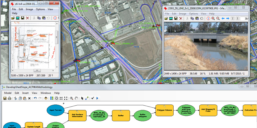
Wood Rodgers was selected by the Alameda County Flood Control & Water Conservation District to develop a significant flood mitigation analysis and design for the entire 3A watershed. This required developing an analysis including a detailed MOUSE hydrologic model of the entire 22-square mile watershed, a MOUSE hydraulic model of 19.5 miles of the closed conduit system, and a MIKE11 hydraulic model of the entire 21.4-mile open channel system (including Alameda Creek). The project includes a large effort to develop the existing geometry from survey data, as-built construction plans, old improvement plans, and extensive field visits.
In order to properly manage the large amounts of data required by the project, Wood Rodgers developed a GIS application that housed the relevant datasets in a geodatabase. Tools were developed using Visual Basic for Applications and ArcObjects to link specific features to appropriate datasets such as as-built construction plans, existing survey geometry data, and site photographs. The application also has links to hydraulic modeling results and model parameter estimation data.


Leave a Comment
You must be logged in to post a comment.